-
Arizona Mining
-
Barr Lake Reservoir Design Modifications for Public Use
-
Barr Lake Spillway
-
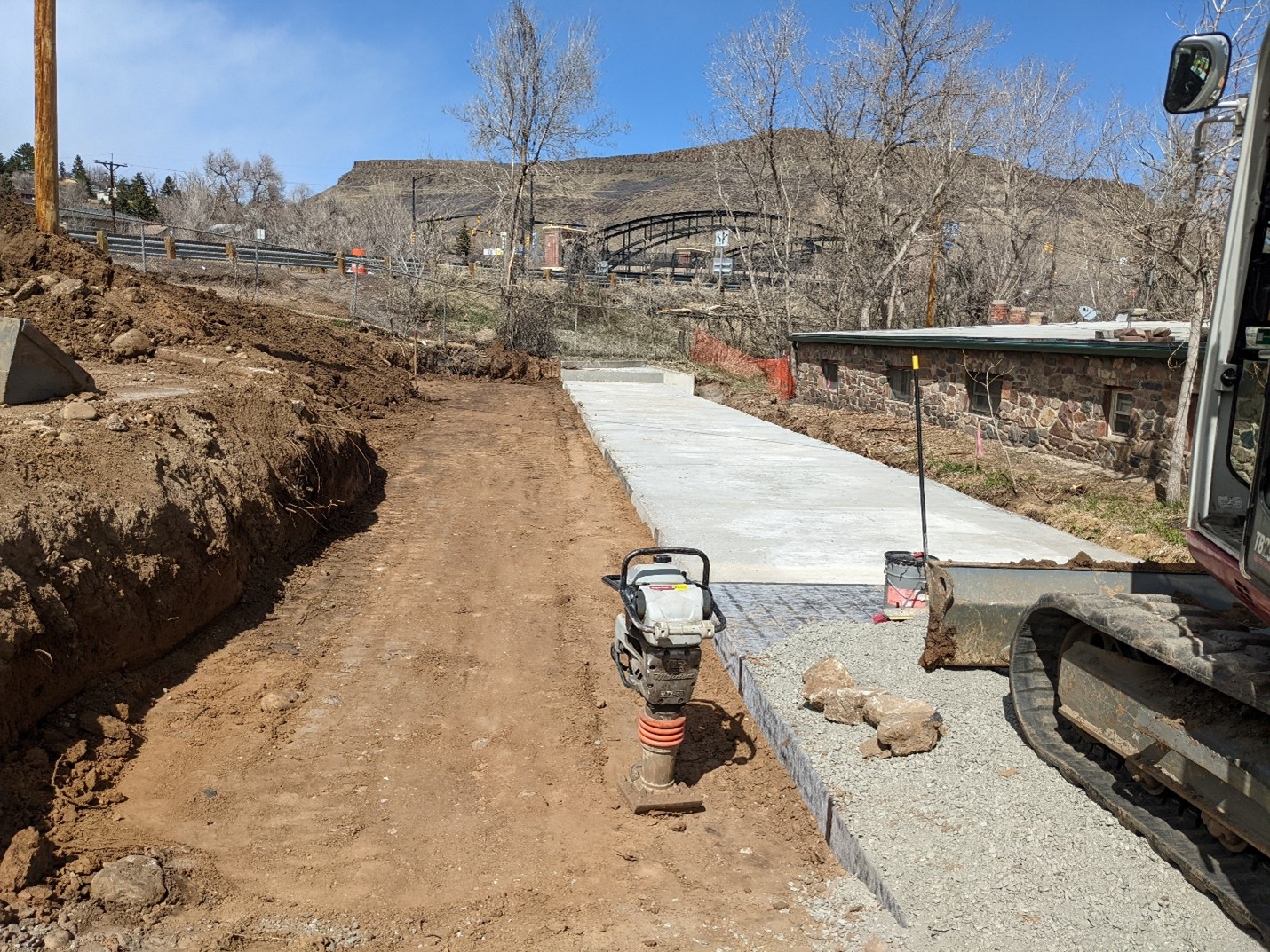
Boulder Creek Master Plan
-
Burlington Canal Headworks
-
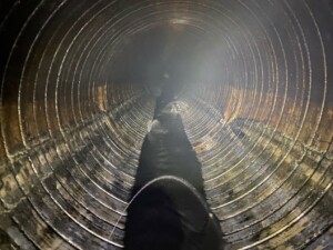
CDWA Culvert Improvement
-
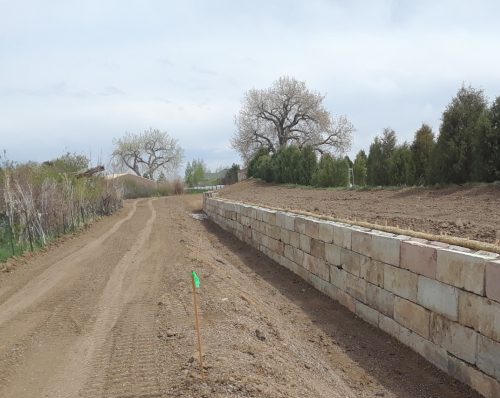
Church Ditch Headgate 53 Retaining Wall
-
Church Ditch Headworks
-
Church Ditch Leyden Flush Structure
-
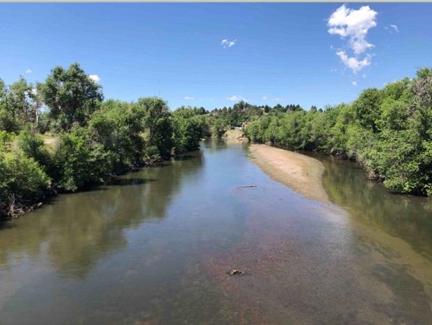
Clear Creek
-
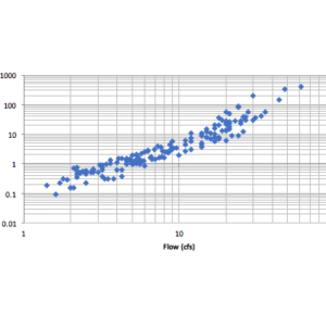
Colorado Stream Quantification Tool
-
Community Ditch Improvements
-

Construction Materials Extraction Operations – DRMS 112c Application Support
-
Cripple Creek & Victor
-
Dam Breach Modeling
-
DDCVDC Design Criteria
-
Denver Water Moffat Project
-
El Limon Guajes Mine Complex
-
El Sauzal Closure
-
Haile Gold Mine Stream Assessment and Monitoring
-
Haile Gold Mine – South Carolina
-
Happy Canyon Creek Geomorphology and Sediment Transport
-
Metro 2nd Creek Interceptor
-
Minera Panama – Panama
-
Newmont Nevada Operations
-
South Platte River (Denver County) Geomorphology and Sediment Transport
-
South Platte River Adams County Geomorphology Assessment
-
South Platte River Adams County Sediment Transport and Geomorphology Health Assessment
-
Standley Lake Monitoring and Dam Break
-
Town of Telluride Open Space Commission
-
Trout Creek Stream Assessment
-
United Reservoir North Cell Pump Station
-
Yampa River Master Plan
Arizona Mining
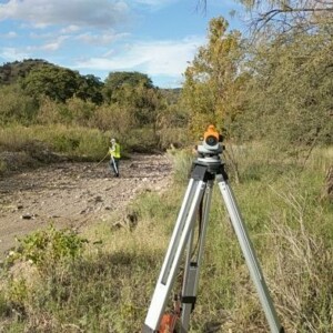
Mining has been a major part of Arizona’s history since well before it was granted statehood in 1912 and continues to be a major industry. ERC has assisted in many aspects of the development of the Hermosa Project in southern Arizona. Some of ERC’s contributions have included completing a dam breach analysis of the mine’s TSF facility to ensure all people and structures will be out of the inundation area in the event of a dam failure and conducting hydraulic and geomorphologic assessments on local ephemeral streams to determine the impact any discharges from the mine’s water treatment plant may have. ERC has also aided the mine in their water management through the development of stochastic water balance models.
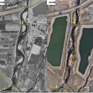
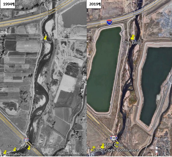
Barr Lake Reservoir Design Modifications for Public Use
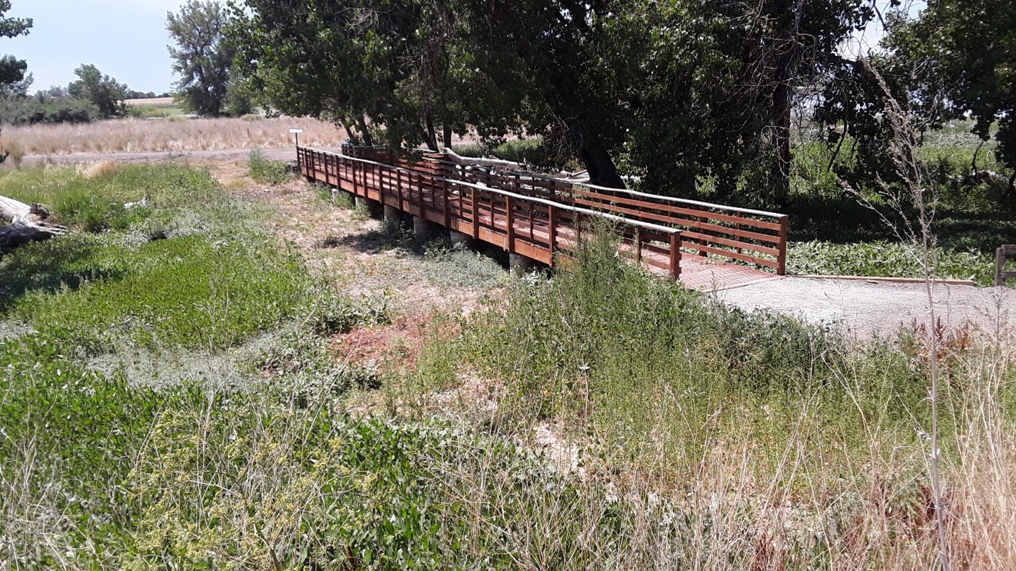
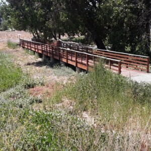
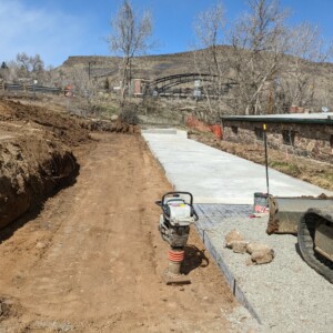
In 2019, a change in State Dam Safety regulations allowed the reservoir at Barr Lake to be enlarged. To protect State Park facilities from the increased water level, ERC undertook a project to identify impacted roads, trails and other infrastructure then design modifications to ensure their continued safe use by the public. Tasks included: developing design drawings and technical specifications to raise 3 gazebo structures, 1 pedestrian bridge, 3,000 linear feet of gravel trail, 800 linear feet of wooden boardwalk on concrete piers, and 3,300 linear feet of gravel road. The facilities were designed to meet Colorado Parks & Wildlife (CPW) standards and current building codes. Construction was completed in 2022.
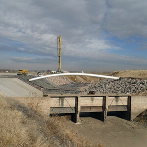
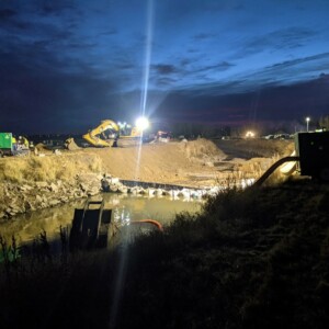
Barr Lake Spillway
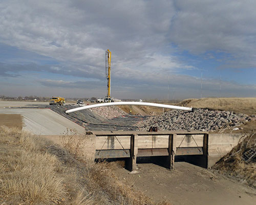
The State of Colorado determined that the spillway at Barr Lake was inadequate to safely pass the inflow design storm. ERC was retained to evaluate existing and future conditions and design a spillway upgrade. ERC evaluated extreme precipitation conditions and defined the Probable Maximum Precipitation of 30 inches in a 48-hour period. When routed the storm produced a peak inflow rate of approximately 40,000 cfs with a total runoff volume of 13,000 acre-feet. Hydraulic modeling showed that a 185 spillway was required to safely pass the inflows while maintaining the required freeboard without raising the dam. The design included replacing the existing earthen spillway with a composite concrete, riprap and soil cement spillway. Additionally, over three miles of perimeter dikes were designed and constructed to control water levels during the design event. ERC completed design, permitting and construction management for the project.
Boulder Creek Master Plan
Boulder Creek, like many of Colorado’s front range streams, was significantly altered by the 2013 floods. ERC was part of a team of consultants tasked with evaluating the environmental and geomorphologic conditions of the stream and developing a master plan for future resilient improvements. ERC evaluated historic aerial photographs of Boulder Creek to understand evolution of the stream’s alignment during recent and pre-development periods. From this assessment, a range of natural sinuosity and meander wavelengths were defined and alignments for future restoration were identified. Typical cross-sectional geometries that replicate natural stream conditions were determined for low flow, bankfull flow and flood flow events. Critical habitat features along the riverine corridor were defined and recommended riparian buffer zones to protect the corridor from further development were determined.
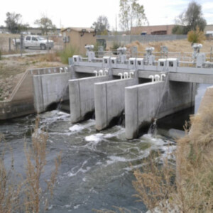
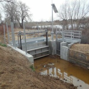
Burlington Canal Headworks
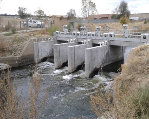
ERC designed and oversaw construction to modernize the main Burlington Canal headworks off of the South Platte River. The diversion structure included four main crest gates (two 6 foot gates and two 12 foot gates) a 4’ x 13’ crest gate for bypass flow operations and a 4’x4’ sandout gate all with flow measuring capabilities. ERC’s work included hydraulic modeling, gate design, 404 and floodplain permitting and construction observation. The completed facility has the ability to pass and measure flows up to approximately 1,000 cfs. Gates were designed to fit within the original Burlington diversion structure while improving operational flexibility and safety.
CDWA Culvert Improvement
In 2019, The Church Ditch Water Authority decided to improve a deteriorating culvert crossing under Arapahoe Street in Golden, CO. ERC was tasked with designing a new culvert and overseeing the construction process. Tasks included: initial site survey and hydraulic design, structural design, preparation of bid documents, helping select a construction contractor, and managing construction. The final design piped the ditch under the road and across adjacent property that was difficult to access and maintain. ERC obtained permits from the City of Golden and the Colorado Department of Transportation (CDOT), and worked closely with adjacent property owners. Construction was completed before the 2022 water-delivery season. The final product eliminated stormwater runoff into the ditch, improved hydraulic efficiency and reduced maintenance headaches.
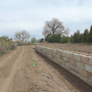
Church Ditch Headgate 53 Retaining Wall
The Church Ditch hired ERC to repair a concrete-block retaining wall holding back high banks along the ditch in Arvada. The wall showed signs of heaving and overturning in several spots due to a poor design and the expansive soils in the area. ERC designed a concrete footer for the existing blocks and a system of steel angles to tie the blocks together. Approximately 800 linear feet of wall was repaired. The sections were between 6 and 10 feet tall. Design work included hydraulics, stability analysis, and permitting. ERC also managed the project by providing construction oversight.
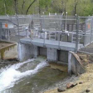
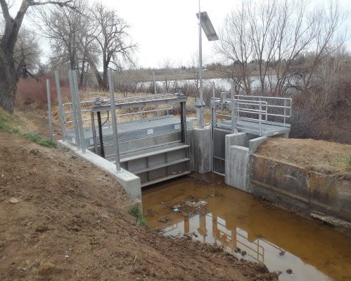
Church Ditch Headworks
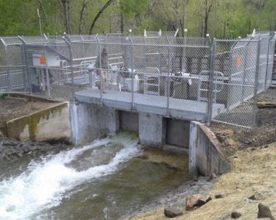
In 2016-2017, ERC managed the project to modernize the headworks structure of the Church Ditch on Clear Creek in Golden, Colorado. During the design phase, ERC conducted hydraulic modeling to size new gates. These included two 4-ft by 4-ft Fresno slide gates, a 4-ft Rubicon overshot gate for controlling upstream head, and a 4-ft slide gate for flushing debris. We also worked with the City of Golden and Jefferson County Open Space to permit the project. In the construction phase, ERC provided bid support to select a contractor then provided oversight and observation to ensure a smooth process. The structure includes security fencing, solar power and the ability to operate the gate and measure flows remotely.
Church Ditch Leyden Flush Structure
The Leyden Flush Structure is a turn-out point for Church Ditch to bypass excess flows and flush sediment and other debris from the upper system. In 2017, the Church Ditch hired ERC to design a new structure to replace the leaky gates, old concrete rickety bridges and a manual stop-log system. ERC designed a new structure to include two concrete headwalls, a 12-ft by 4-ft canal slide gate, a 4-ft by 4-ft Rubicon SlipGate for flushing, two steel access bridges, and security fencing. The gates are solar powered and remotely operable. Design work included hydraulic modeling and gate sizing. ERC also managed the project by providing construction oversight.
Clear Creek
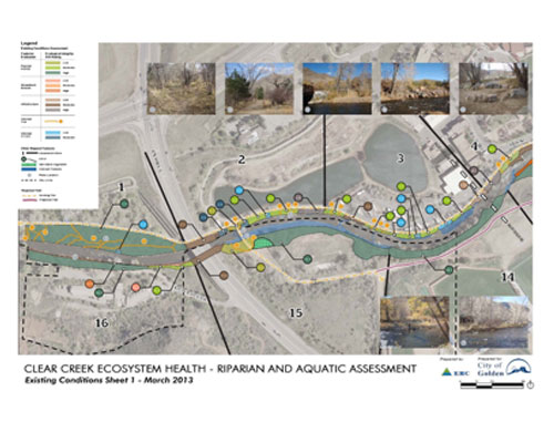
Golden, CO
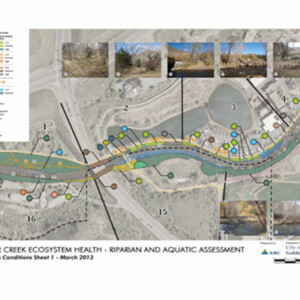
Clear Creek serves as an integral component of the City of Golden. The City in recent years has undertaken significant efforts in developing the Creek corridor as a recreational and natural focal point with the city. Through improvements and planning the corridor has developed into an extremely successful public amenity as observed by high year round recreational and visitor use. This high recreational use and great demand periodically exceeds the corridor’s capacity. A growing concern has developed that when high recreational use exceeds capacity, not only does user conflict increase and experience quality decrease, but the riparian and aquatic ecosystem health may also be significantly at risk. ERC was contracted by the City to conduct an assessment of the corridor in the context of riparian and aquatic ecosystem health as well as provide potential ecosystem protection and management strategies. The Project Area included approximately 1-mile of Clear Creek extending through the heart of the City.
ERC performed an existing conditions assessment of the Creek corridor to identify the gradient of ecological condition by identifying areas of high, moderate and low ecological integrity. Based on the existing condition assessment and a thorough understanding of recreational use patterns, ERC developed ecosystem protection and management strategies which focused on proving enjoyable and safe recreation use while preserving and enhancing the ecological integrity of the Creek natural resources. Sixty specific areas of interest were identified. Management strategies were developed for each area of interest, ranging from preservation of existing high quality habitats through use elimination, bio-engineered bank stabilization, structural stabilization (boulder terrace), formalized access points and riparian habitat restoration. ERC assisted the City with public open house presentations of the project as well as detailed design development, project prioritization, USACE permitting, City floodplain permitting and construction implementation of select improvements.
Colorado Stream Quantification Tool

ERC’s multi-disciplinary professional staff provides complete inhouse assessment of streams utilizing the Colorado Stream Quantification Tool (CSQT). The CSQT is a stream condition assessment method developed as a result of a multi-agency collaborative effort led by USACE and USEPA to establish an objective, measurable, repeatable method to calculate debits and credits for stream impacts and mitigation in accordance with the Clean Water Act Section 404 2008 Mitigation Rule and Colorado Mitigation Procedures. ERC has completed the CSQT in support of numerous project types including Mile High Flood District drainage improvement projects, private mining companies and mixed use development projects as well as for local municipality kayak parks within both the Omaha and Albuquerque District USACE offices
.
Community Ditch Improvements
The Community Ditch through Eldorado Canyon was historically one of FRICO’s most difficult sections to maintain of its 400 mile canal system. Bank sloughing, icing, seepage, liner damage and limited access all contributed to operational challenges in this section. FRICO hired ERC to develop a solution that would allow water to be conveyed through this ½ mile section in a more efficient manner. ERC’s solution replaced the open trapezoidal channel with a box culvert. The culvert was designed to fit within the narrow, meandering confines of the old ditch alignment, which allowed for only inches of tolerance in the box design. Maintenance access, which had not existed through this section, was provided on the top of the culvert. Design work included hydraulic modeling, modifications to intake gates and measuring devices, evaluation of rockfall hazards and Boulder County permitting.
Construction Materials Extraction Operations – DRMS 112c Application Support
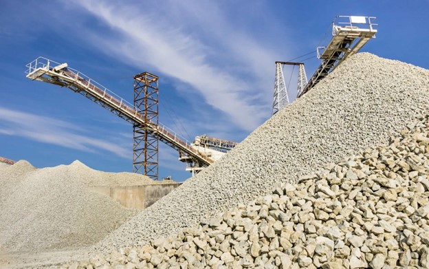
Ecological Resource Consultants, Inc. (ERC) provides technical support as part of the State of Colorado Division of Reclamation, Mining and Safety for Construction and Material (112c) Operations Reclamation Permit Applications pursuant to Title 34 Article 32.5 of the Colorado Land Reclamanation Act. ERC has prepared Wildlife Information per Rule 6.4.8 (Exhibit H) for compliance of Rule 3.1.8(1), Vegetation Information per Rule 6.4.10 (Exhibit J) and provides expert testimony during DRMS Board hearings. ERC also provides Clean Water Section 404 and Endangered Species Act compliance for these projects. ERC has provided these services for numerous operation applications across the state of Colorado including; Boulder, Weld, Summit, Gilpen, Jefferson, Grand, Mesa, Teller and Prowers Counties.
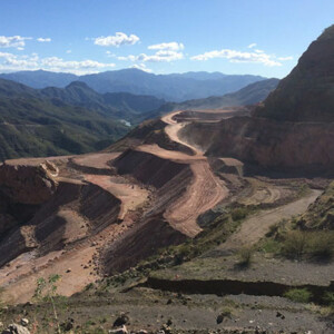
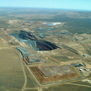
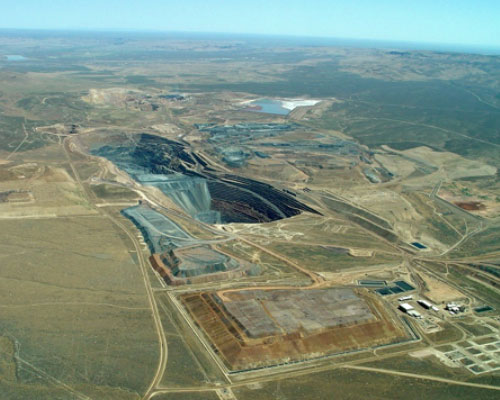
Cripple Creek & Victor
The gold mines that eventually became the Cripple Creek & Victor (CCV&V) gold mine were first founded in 1892. It is currently the largest producer of gold in Colorado and operates using heap leach processes to recover gold from the ore. ERC has assisted CC&V in their water management for the past several years, by means such as creating complex stochastic water balance models for different phases of the mining operations to help the mine understand their water availability and use it most efficiently. ERC has also designed diversion channels, stilling basins, and sediment ponds for mining conditions as well as runoff channels for closure conditions.
Dam Breach Modeling
ERC has completed several dam breach analyses for municipal reservoirs and mining facilities in states such as Colorado, Arizona, Montana, and South Carolina, among others. The analyses have included sizing flow hydrographs resulting from a dam breach, mapping flood inundation extents (using both one-dimensional and two-dimensional modeling methodology), and determining the downstream hazard classification of each dam in respect to local regulations. ERC has also aided in the creation of Emergency Action Plans (EAPs) for the dams where the downstream hazard potential of the dam is found to be great enough to require one.
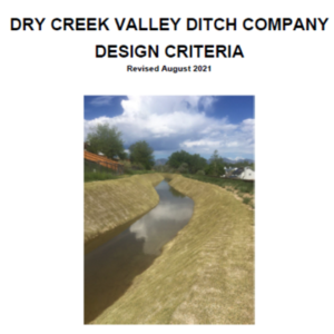
DDCVDC Design Criteria

In 2021, ERC worked with the Dry Creek Valley Ditch Company (DCVDC) to revise their Design Criteria Manual. The manual provides guidance for shareholders, developers, and other applicants interested in constructing projects in and around DCVDC facilities. The criteria describe the design review process, fees, and the technical and administrative requirements for obtaining the necessary permits and agreements to complete a project. The manual serves as a how-to guide for those interested in developing adjacent to DCVDC facilities and ensures a high standard of technical design and construction to protect the ditch company and its shareholder. Under the new criteria manual, DCVDC has permitted culvert crossings, ditch relocations/piping, adjacent stormwater detention facilities and other development without impacting ditch operations or maintenance.
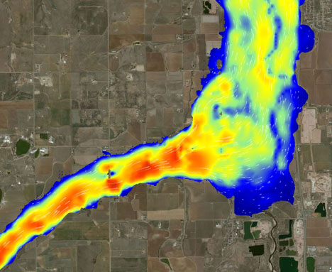
Denver Water Moffat Project
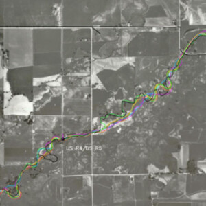
ERC was the stream morphology and sediment transport resource specialist tasked with evaluating impacts of Denver Water’s Moffat project on front-range and west slope stream systems. Channel evaluations encompassed over 200 miles of streams including the Fraser, Williams Fork, Colorado and Blue River on the west slope and South Boulder Creek and the North Fork of the South Platte River in the front range. Field work included site assessments, surveying and sediment sampling. Existing stream conditions and recent trends in channel evolution were evaluated from this field program, evaluation of historic conditions (aerial and ground photos, assessment of USGS stream gage shifts and repeated historic cross-sectional surveys for signs of aggradation or degradation) and numeric modeling. Modeling defined sediment supply, sediment transport capacity, effective discharge, the frequency of Phase 2 sediment transport and the magnitude of specified recurrence interval flood flows. Quantitative and qualitative stream impacts anticipated as the result of the planned Moffat project were determined by defining flow changes associated with the project and overlaying these hydrologic alterations on knowledge of the behavior and resiliency of the existing stream systems. ERC’s work included design of front-range and western slope stream mitigation aimed at providing functional stream uplift to offset project impacts following the stream functional pyramid approach.
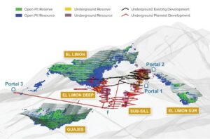
El Limon Guajes Mine Complex
ERC has worked Torex Gold Company and several other consultants to develop a stochastic water balance model of the El Limón Guajes Mine Complex (ELG). The site includes three open pits, a deep underground mine, several water storge ponds and a mill capable of processing 13,000 tonnes per day. ERC created a GoldSim model to evaluate the use of water throughout the mine site, including management of runoff, well pumping, and reuse at the mill site. The model also evaluates the future use of water once Torex begins mining ore from the Media Luna underground mine. The model was used for permitting of the and was calibrated with local data to provide the best estimates of potential outcomes.
El Sauzal Closure
Water management was a significant challenge at the El Sauzal mine given the site’s steep topography and flashy rainfall history. ERC was retained to develop a diversion and water management plan for the mine’s closure. Site and historic regional precipitation records were evaluated to define the magnitude of rainfall expected at various frequencies. A risk assessment was completed to consider flow frequency and facility sizing. Based on this analysis the mine selected the 100-year storm event for design. ERC’s design included over six kilometers of channel. Design also included sediment ponds, energy dissipation structures, stilling basins and rundowns. Due to the varied flows, slopes and ground conditions a number of types of channel armoring were required with armoring including vegetation, bedrock, concrete and geowebs.
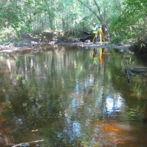
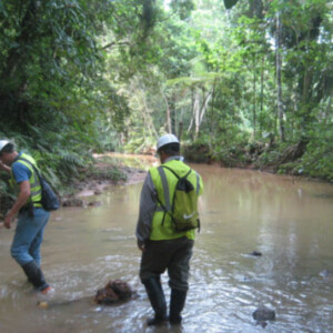
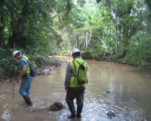
Haile Gold Mine Stream Assessment and Monitoring
The Haile Gold Mine is going to alter flows in area streams within and adjacent to the mine development. ERC was retained to evaluate and document flows and stream conditions within the mine, adjacent to development and in areas outside of the zone of influence of the mine to facilitate the long-term assessment of potential mine impacts. Baseline studies included stream surveys, sediment sampling, bank stability evaluations and flow quantification. As part of this initial assessment ERC established permanent monitoring sites and designed a system of flumes, weirs and USGS type stream gages for flow measurements. Nested piezometers were designed and installed to inform the understanding of variability in surface flows and groundwater levels and their joint contributions to the riparian wetland system that exists on site.
Haile Gold Mine – South Carolina
Gold was first discovered in Lancaster County, South Carolina in the 1820s. In 2007 Romarco Minerals acquired the property and began the process of planning, designing and permitting a modern mine at this historic location. ERC provided water resource and environmental consulting services through feasibility, permitting and final design. Environmental work included baseline wetland delineations, habitat functional assessments and impact assessments. Water resource work included climate evaluations, hydrologic and hydraulic assessments, water balance modeling, water supply assessments, spillway design and erosion control. ERC was particularly instrumental throughout the permitting process given our technical and regulatory expertise. We worked with the Corps and their third-party contractor during the EIS process and helped secure permitting which has led to operations of what will become the largest gold mine in the eastern US.
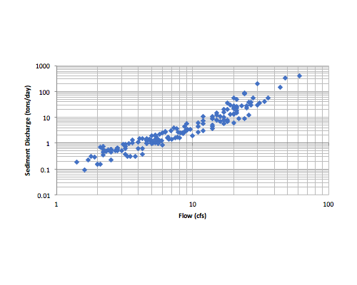
Happy Canyon Creek Geomorphology and Sediment Transport
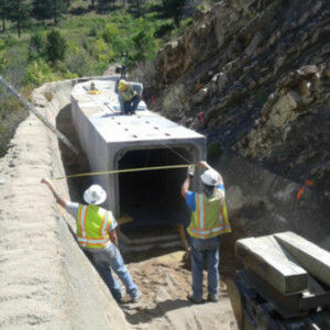
ERC was requested by Jacobs Engineering to assist with the evaluation of channel morphology and sediment transport conditions of Happy Canyon Creek in the reach located in Centennial, Colorado. Happy Canyon Creek is an ephemeral stream, with flow only occurring following precipitation events. ERC evaluated channel morphology and completed a sediment transport analysis of an approximately 4.0-mile segment of Happy Canyon Creek starting at the confluence with Cherry Creek and ending just upstream of E Lincoln Ave. ERC’s work and the on-going work led by Jacobs is being completed with the goal of understanding the hydrology, hydraulics, and channel morphology of the system to inform a future design that improves the health of the system and reduces sediment loading into Cherry Creek. ERC’s work included field reconnaissance, understanding the sediment regime of the stream, and creating a mobile bed sediment transport model that can be used as a tool to guide future design efforts. The Corps of Engineer’s 1-dimensional (1D) River Analysis System HEC-RAS (v.6.2) was used to evaluate existing conditions and complete precursory assessments of potential future scenarios.
Metro 2nd Creek Interceptor
ERC represented FRICO through the design approval process and construction of a major pipeline crossing of the Burlington/O’Brian Canal. To minimize canal shutdown time, a temporary bypass canal sized to convey 150-cfs was constructed. The project was allowed a 48-hour canal shut down window to connect and disconnect the temporary bypass. A 66-inch steel casing pipe containing a 48-inch sewer pipe was constructed across the Burlington/O’Brian Canal while the canal continued to operate through the temporary bypass. The project site is located near a major creek and significant dewatering was required during the project. The project was completed successfully and on-time within the agreed upon schedule and minimized impact to FRICO ‘s water conveyance.
Temporary Bypass
Pipeline Crossing
Temporary Bypass Confluence
Temporary Bypass Removal and Canal Restoration
Minera Panama – Panama
With its location in the rainforest and in an environment that receives nearly 5 meters of annual rainfall, water management is one of the critical technical challenges for Minera Panama. ERC was brought into the project due to its experience characterizing and developing water management plans for mines in locations with extreme climatic conditions. Our first task was to establish estimates of design rainfall events and associated runoff for short-term and extended wet cycle conditions. Our next challenge was water diversion. The main local river, the Rio Botija, ran right through the initial mining target and needed to be diverted around the planned pit. ERC’s design included a risk based assessment of tradeoffs between design storms and allowable pit flooding. The ultimate design required lining to minimize seepage and related instability adjacent to the pit wall for the 2 kilometer channel. Finally ERC developed an operational water balance model for mine personnel use in managing pit sumps and surface water dewatering systems.
Newmont Nevada Operations
ERC has provided water resource and environmental services to Newmont Mining Corporation at their eight Nevada sites. At all locations, accurate quantification of water requirements and needed storage capacity is paramount to efficient and safe operations. Climatological conditions have been quantified to allow the mines to understand both short-term and multi-month and year weather conditions that can impact water management. Probabilistic water balance modeling has been completed to predict operational variability at tailings storage facilities, heap leaches and operations that have multiple interlinked facilities. ERC’s stochastic models have been used for project planning, permitting, design and closure scenarios. We have been involved in overall water management of facilities including estimates of fresh water requirements and design of diversion channels and sediment control measures. ERC has also provided ecological planning and design services for heap cover/closure design, revegetation planning and landscape-based closure reclamation.
South Platte River (Denver County) Geomorphology and Sediment Transport
As part of the South Platte River Needs Assessment, the City and County of Denver desired to gain a better understanding of channel morphology and sediment transport throughout the project reach within Denver County. One purpose of this task was to develop a tool that identifies existing locations where degradation and aggradation are expected. Given this tool, the City and County can evaluate projected impacts to sediment continuity from proposed future modifications to the South Platte River and its corridor. A quasi steady-state HEC-RAS model was developed for this purpose. It is anticipated that the model will be used to evaluate impacts of potential projects such as removal of grade control structures, bridge construction, and planned restoration efforts to better understand stream responses to the larger river system.
South Platte River Adams County Geomorphology Assessment
As part of the Adams County Coalition: South Platte River Vision and Implementation Plan, ERC performed a reconnaissance level geomorphology assessment of the South Platte River throughout the project reach within Adams County. The geomorphology assessment consisted of evaluating and comparing existing and historical conditions. Next, the sediment setting was analyzed to identify sedimentation trends within the river. Two standard classification systems, Rosgen and Montgomery-Buffington, were employed using the project reach’s physical characteristics and river’s processes. The stream’s resilience to change and stability were evaluated, and its past and potential future evolutionary trends were discussed.
South Platte River Adams County Sediment Transport and Geomorphology Health Assessment
As part of the South Platte River Corridor Needs Assessment, the City and County of Denver desired to gain a better understanding of river health throughout the project reach within Adams County. ERC contributed to this effort by evaluating the geomorphological condition and needs of the project area. A quasi steady-state HEC-RAS model that identifies existing locations where degradation and aggradation are expected. For the needs assessment related to geomorphology, existing channel width, sediment transport, and meander belt width were selected as parameters that captured overall stream health. The assessment evaluated these parameters and summarized the metrics used to score them for a comparative evaluation of the 13 different reaches within the project area. As part of the assessment, the model generated to evaluate geomorphologic parameters was also run to be able to evaluate hydraulic conditions at different flows that can be used to characterize river health.
Standley Lake Monitoring and Dam Break
ERC is responsible for the on-going monitoring and reporting of Standley Lake Dam in Westminster, CO. This large, high-hazard dam provides water to nearly 300,000 residential and is located in a highly urbanized area. ERC completes monthly inspections, monitors reservoir and phreatic levels, evaluates crack gages and inclinometers and provides reports to dam owners and the State Engineers Office. For emergency planning purposes ERC has modeled dam breach scenarios and prepared inundation mapping for use by local emergency managers. We have designed repairs to ancillary facilities including outlet works, the dam’s spillway and the headgate structure that diverts up to approximately 1,000 cfs into the Lake.
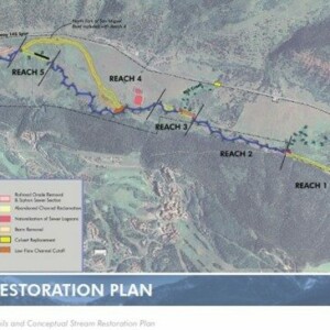
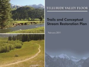
Town of Telluride Open Space Commission
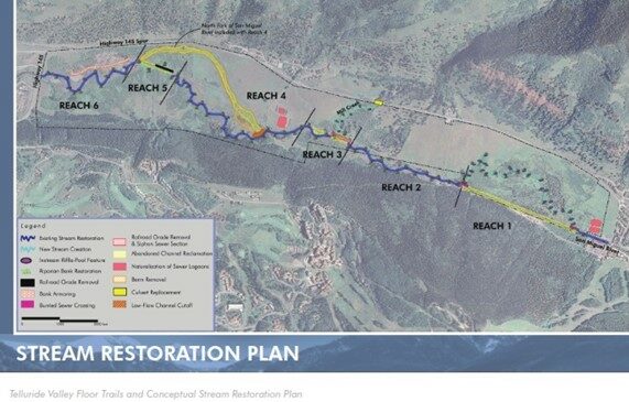
Ecological Resource Consultants, Inc. (ERC) worked with the Town of Telluride to prepare the Telluride Valley Floor Trails and Conceptual Stream Restoration Plan (Plan). The Plan was intended to be a living document to help guide the Town as it moves to implement a comprehensive trails and conceptual stream restoration plan for the Valley Floor open space property. The Plan was developed to identify key project components and design elements that will allow the Town to make improvements to the stream system offsetting the past century of impacts. The Plan is comprehensive in context and includes both simple, inexpensive improvements and more complex, costly recommendations. Thus, the Plan provides a foundation for moving forward with certain recommendations in the short-term and serves as an approved policy document as the Town seeks funding and partners for large scale restoration projects. Cost estimates and recommendations for logical phasing of improvements are included in the Plan.
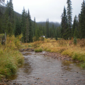
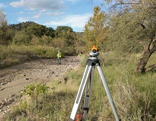
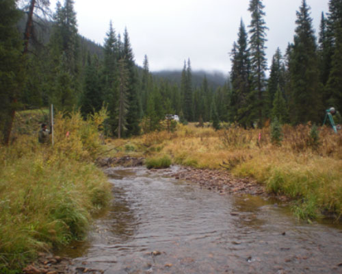
Trout Creek Stream Assessment
Peabody Coal’s planned Trout Creek reservoir would alter the flow regime, sediment conveyance and stream conditions in Trout Creek. ERC was hired as part of the FERC process to evaluate baseline stream conditions and assess potential impacts of the planned on-line dam. Field work included stream classification, cross sectional and longitudinal stream surveys, pebble counts, suspended and bedload sediment sampling and bank stability characterization. Using this exiting conditions data, ERC projected sediment inflows to the reservoir and changes in sediment conveyance and channel morphology that could be expected to occur as a result of the dam.
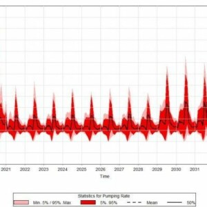
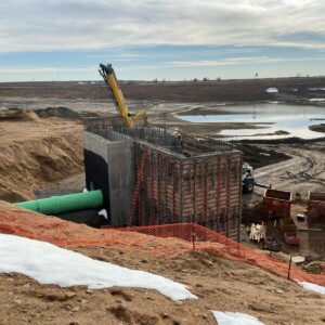
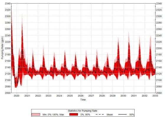
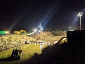
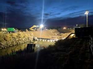
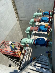
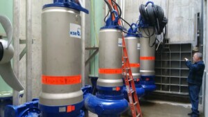
United Reservoir North Cell Pump Station
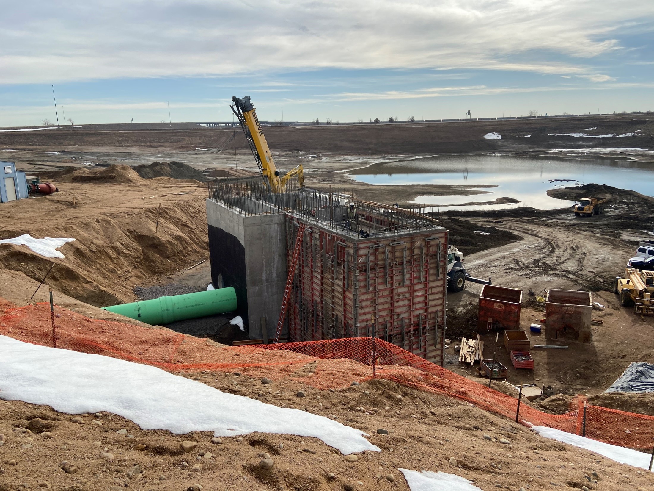
The United Reservoir North Cell Pump Station project consisted of replacing the existing system to accommodate the adjacent enlarged storage reservoir, to improve the functionality of the system, and to better manage excess sediments inherent to the river intake water. The pump station is used to divert flows from the South Platte River to Barr Lake and United’s North & South cells. The pump station is fed by or can return flow to the river via three large diameter pipes. The pump station consists of a connected two-celled wet well structure with a deep (64’) and a shallow (38’) rectangular (25’ x 11”) compartment. Both high and low head submersible pumps were installed in the wet wells along with discharge piping that allows for a variety of pumping scenarios up to a maximum rate of 50 cfs to Barr Lake. A gate is located between the two compartments to control hydraulic connectivity between the two wetwells depending on the specific pumping operation in use. Water is pumped to Barr Lake through a 36” ductile iron pipe. The system is automated and can be controlled remotely.
A schematic of the system is shown below along followed by a summary of the design components.
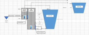
To help mitigate problems caused by disruption to the pumping operations and minimize downtime due to maintenance and cleaning of sediments and debris the following controls were included:
• Sediment/Debris basin positioned between the river intake pipes discharge and the shallow wet well. This basin can be accessed via a vac truck hose for solids removal.
• Removeable screens between the river intake pipes discharge and the pumps.
• Low head submersible pumps with a higher solids content threshold.
• Added redundancy with multiple pumps (four 12.5 cfs high head).
• Capability to pump to Barr Lake from either the shallow or deep wet well.
• Built in sprays used to keep silts suspended and prevent a buildup of solids in the shallow wet well.
• Flexibility to close river feed and pump directly from the North Cell if the sediment load from the river is high and there is enough water in the North Cell.
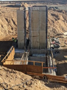
Concrete Wet wells under construction. Deep well~65′ deep; Shallow well ~35′ deep
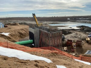
South River Intake Pipe Connection to Wet Well (Sediment Collection Bay)
Existing Ultraflow Pipe from River with Sliplined Hobas Pipe
Deteriorated Existing Ultraflow Pipe condition
Pump Discharge Header Shallow Well
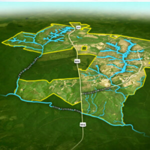
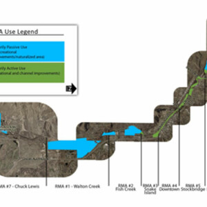
Yampa River Master Plan
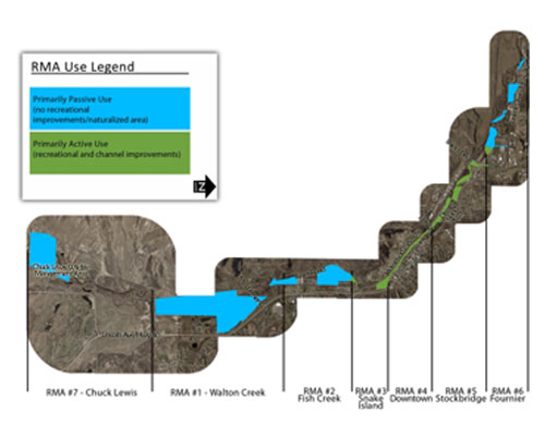
Steamboat Springs, CO
The Yampa River through the City of Steamboat Springs is a prized amenity attracting thousands of visitors for active and passive recreation. However, this popularity was creating a negative impact to the riparian corridor and conflict amongst the variety of users. ERC was hired by the City of Steamboat Springs to develop a Yampa River Master Plan to provide a framework for instream and riparian area improvements to optimize the recreational benefits of the Yampa River while protecting its ecological integrity. The plan covered the river and adjacent property on City owned and controlled property (6.4 miles) along the Yampa River. The plan prioritized recommended improvements and provided budgetary cost estimates for City implementation.
ERC hosted multiple public meetings where the technical, administrated and operations and maintenance issues associated with the current river and proposed improvements were discussed. This public input, combined with river reconnaissance performed by ERC and the results of past studies, was the basis for the identification of seven separate River Management Areas (RMAs). Each RMA represents a portion of the river where management priorities such as recreation, flood protection and natural restoration objectives may differ. Within these seven RMAs a combined total of 86 individual areas for restoration were identified. Community input and ERC’s technical evaluation were used to rank the relative priority of each of the improvement areas. Conceptual level designs were developed for each of the 86 improvement areas, which were then used to estimate the budgetary costs required for all proposed improvements. In total the defined improvements were estimated to cost over $5.1 million in 2008 dollars. The City has since used the Master Plan to assist in fundraising and has completed many of the individual restoration improvements identified in the Master Plan.