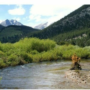
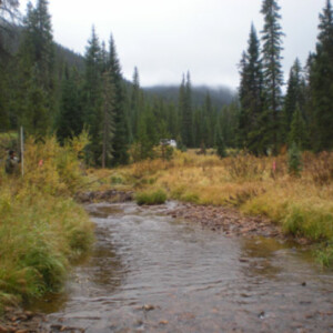
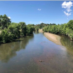
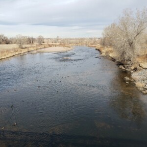
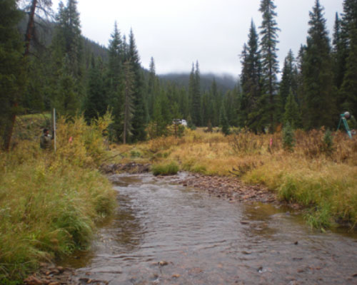
Boulder Creek Master Plan

Boulder Creek Master Plan

Boulder Creek, like many of Colorado’s front range streams, was significantly altered by the 2013 floods. ERC was part of a team of consultants tasked with evaluating the environmental and geomorphologic conditions of the stream and developing a master plan for future resilient improvements. ERC evaluated historic aerial photographs of Boulder Creek to understand evolution of the stream’s alignment during recent and pre-development periods. From this assessment, a range of natural sinuosity and meander wavelengths were defined and alignments for future restoration were identified. Typical cross-sectional geometries that replicate natural stream conditions were determined for low flow, bankfull flow and flood flow events. Critical habitat features along the riverine corridor were defined and recommended riparian buffer zones to protect the corridor from further development were determined.

Project Categories:
stream-assessments

Clear Creek

Clear Creek

Golden, CO

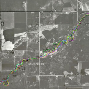
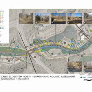
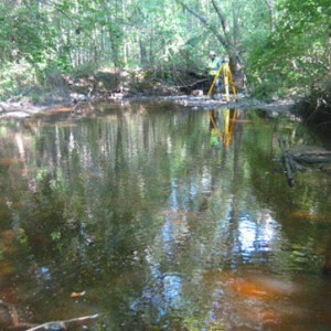
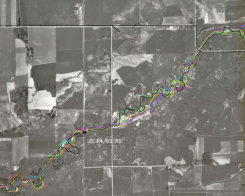
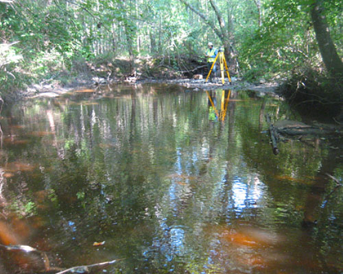
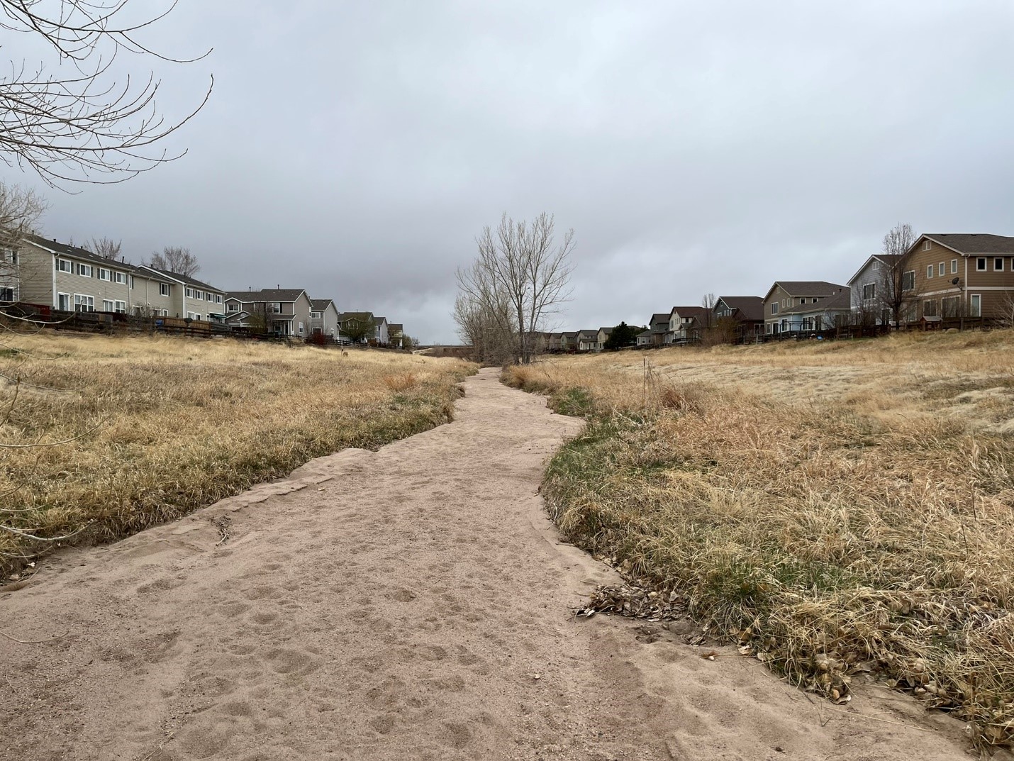
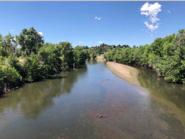
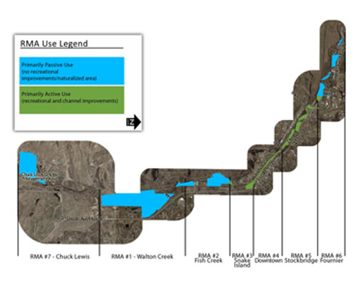
Clear Creek serves as an integral component of the City of Golden. The City in recent years has undertaken significant efforts in developing the Creek corridor as a recreational and natural focal point with the city. Through improvements and planning the corridor has developed into an extremely successful public amenity as observed by high year round recreational and visitor use. This high recreational use and great demand periodically exceeds the corridor’s capacity. A growing concern has developed that when high recreational use exceeds capacity, not only does user conflict increase and experience quality decrease, but the riparian and aquatic ecosystem health may also be significantly at risk. ERC was contracted by the City to conduct an assessment of the corridor in the context of riparian and aquatic ecosystem health as well as provide potential ecosystem protection and management strategies. The Project Area included approximately 1-mile of Clear Creek extending through the heart of the City.

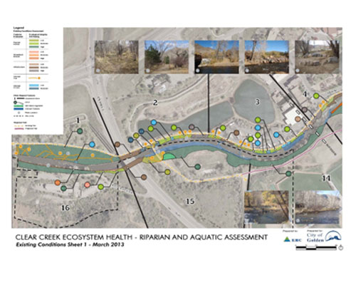
ERC performed an existing conditions assessment of the Creek corridor to identify the gradient of ecological condition by identifying areas of high, moderate and low ecological integrity. Based on the existing condition assessment and a thorough understanding of recreational use patterns, ERC developed ecosystem protection and management strategies which focused on proving enjoyable and safe recreation use while preserving and enhancing the ecological integrity of the Creek natural resources. Sixty specific areas of interest were identified. Management strategies were developed for each area of interest, ranging from preservation of existing high quality habitats through use elimination, bio-engineered bank stabilization, structural stabilization (boulder terrace), formalized access points and riparian habitat restoration. ERC assisted the City with public open house presentations of the project as well as detailed design development, project prioritization, USACE permitting, City floodplain permitting and construction implementation of select improvements.

Project Categories:
stream-assessments

Colorado Stream Quantification Tool


ERC’s multi-disciplinary professional staff provides complete inhouse assessment of streams utilizing the Colorado Stream Quantification Tool (CSQT).  The CSQT is a stream condition assessment method developed as a result of a multi-agency collaborative effort led by USACE and USEPA to establish an objective, measurable, repeatable method to calculate debits and credits for stream impacts and mitigation in accordance with the Clean Water Act Section 404 2008 Mitigation Rule and Colorado Mitigation Procedures. ERC has completed the CSQT in support of numerous project types including Mile High Flood District drainage improvement projects, private mining companies and mixed use development projects as well as for local municipality kayak parks within both the Omaha and Albuquerque District USACE offices

.

Project Categories:
csqt
stream-assessments

Denver Water Moffat Project

Moffat EIS

ERC was the stream morphology and sediment transport resource specialist tasked with evaluating impacts of Denver Water’s Moffat project on front-range and west slope stream systems. Channel evaluations encompassed over 200 miles of streams including the Fraser, Williams Fork, Colorado and Blue River on the west slope and South Boulder Creek and the North Fork of the South Platte River in the front range. Field work included site assessments, surveying and sediment sampling. Existing stream conditions and recent trends in channel evolution were evaluated from this field program, evaluation of historic conditions (aerial and ground photos, assessment of USGS stream gage shifts and repeated historic cross-sectional surveys for signs of aggradation or degradation) and numeric modeling. Modeling defined sediment supply, sediment transport capacity, effective discharge, the frequency of Phase 2 sediment transport and the magnitude of specified recurrence interval flood flows. Quantitative and qualitative stream impacts anticipated as the result of the planned Moffat project were determined by defining flow changes associated with the project and overlaying these hydrologic alterations on knowledge of the behavior and resiliency of the existing stream systems. ERC’s work included design of front-range and western slope stream mitigation aimed at providing functional stream uplift to offset project impacts following the stream functional pyramid approach.

Project Categories:
stream-assessments

Haile Gold Mine Stream Assessment and Monitoring

Haile Gold Mine Stream Assessment and Monitoring

The Haile Gold Mine is going to alter flows in area streams within and adjacent to the mine development. ERC was retained to evaluate and document flows and stream conditions within the mine, adjacent to development and in areas outside of the zone of influence of the mine to facilitate the long-term assessment of potential mine impacts. Baseline studies included stream surveys, sediment sampling, bank stability evaluations and flow quantification. As part of this initial assessment ERC established permanent monitoring sites and designed a system of flumes, weirs and USGS type stream gages for flow measurements. Nested piezometers were designed and installed to inform the understanding of variability in surface flows and groundwater levels and their joint contributions to the riparian wetland system that exists on site.

Project Categories:
stream-assessments

Happy Canyon Creek Geomorphology and Sediment Transport

ERC was requested by Jacobs Engineering to assist with the evaluation of channel morphology and sediment transport conditions of Happy Canyon Creek in the reach located in Centennial, Colorado. Happy Canyon Creek is an ephemeral stream, with flow only occurring following precipitation events. ERC evaluated channel morphology and completed a sediment transport analysis of an approximately 4.0-mile segment of Happy Canyon Creek starting at the confluence with Cherry Creek and ending just upstream of E Lincoln Ave. ERC’s work and the on-going work led by Jacobs is being completed with the goal of understanding the hydrology, hydraulics, and channel morphology of the system to inform a future design that improves the health of the system and reduces sediment loading into Cherry Creek. ERC’s work included field reconnaissance, understanding the sediment regime of the stream, and creating a mobile bed sediment transport model that can be used as a tool to guide future design efforts. The Corps of Engineer’s 1-dimensional (1D) River Analysis System HEC-RAS (v.6.2) was used to evaluate existing conditions and complete precursory assessments of potential future scenarios.

Project Categories:
stream-assessments

South Platte River (Denver County) Geomorphology and Sediment Transport

As part of the South Platte River Needs Assessment, the City and County of Denver desired to gain a better understanding of channel morphology and sediment transport throughout the project reach within Denver County. One purpose of this task was to develop a tool that identifies existing locations where degradation and aggradation are expected. Given this tool, the City and County can evaluate projected impacts to sediment continuity from proposed future modifications to the South Platte River and its corridor. A quasi steady-state HEC-RAS model was developed for this purpose. It is anticipated that the model will be used to evaluate impacts of potential projects such as removal of grade control structures, bridge construction, and planned restoration efforts to better understand stream responses to the larger river system.

Project Categories:
stream-assessments

South Platte River Adams County Geomorphology Assessment

As part of the Adams County Coalition: South Platte River Vision and Implementation Plan, ERC performed a reconnaissance level geomorphology assessment of the South Platte River throughout the project reach within Adams County. The geomorphology assessment consisted of evaluating and comparing existing and historical conditions. Next, the sediment setting was analyzed to identify sedimentation trends within the river. Two standard classification systems, Rosgen and Montgomery-Buffington, were employed using the project reach’s physical characteristics and river’s processes. The stream’s resilience to change and stability were evaluated, and its past and potential future evolutionary trends were discussed.

Project Categories:
stream-assessments

South Platte River Adams County Sediment Transport and Geomorphology Health Assessment

As part of the South Platte River Corridor Needs Assessment, the City and County of Denver desired to gain a better understanding of river health throughout the project reach within Adams County. ERC contributed to this effort by evaluating the geomorphological condition and needs of the project area. A quasi steady-state HEC-RAS model that identifies existing locations where degradation and aggradation are expected. For the needs assessment related to geomorphology, existing channel width, sediment transport, and meander belt width were selected as parameters that captured overall stream health. The assessment evaluated these parameters and summarized the metrics used to score them for a comparative evaluation of the 13 different reaches within the project area. As part of the assessment, the model generated to evaluate geomorphologic parameters was also run to be able to evaluate hydraulic conditions at different flows that can be used to characterize river health.

Project Categories:
stream-assessments

Town of Telluride Open Space Commission

Ecological Resource Consultants, Inc. (ERC) worked with the Town of Telluride to prepare the Telluride Valley Floor Trails and Conceptual Stream Restoration Plan (Plan).  The Plan was intended to be a living document to help guide the Town as it moves to implement a comprehensive trails and conceptual stream restoration plan for the Valley Floor open space property.  The Plan was developed to identify key project components and design elements that will allow the Town to make improvements to the stream system offsetting the past century of impacts.  The Plan is comprehensive in context and includes both simple, inexpensive improvements and more complex, costly recommendations.  Thus, the Plan provides a foundation for moving forward with certain recommendations in the short-term and serves as an approved policy document as the Town seeks funding and partners for large scale restoration projects. Cost estimates and recommendations for logical phasing of improvements are included in the Plan.

Trout Creek Stream Assessment

Trout Creek Stream Assessment

Peabody Coal’s planned Trout Creek reservoir would alter the flow regime, sediment conveyance and stream conditions in Trout Creek. ERC was hired as part of the FERC process to evaluate baseline stream conditions and assess potential impacts of the planned on-line dam. Field work included stream classification, cross sectional and longitudinal stream surveys, pebble counts, suspended and bedload sediment sampling and bank stability characterization. Using this exiting conditions data, ERC projected sediment inflows to the reservoir and changes in sediment conveyance and channel morphology that could be expected to occur as a result of the dam.

Project Categories:
stream-assessments

Yampa River Master Plan

Yampa River Master Plan

Steamboat Springs, CO

The Yampa River through the City of Steamboat Springs is a prized amenity attracting thousands of visitors for active and passive recreation. However, this popularity was creating a negative impact to the riparian corridor and conflict amongst the variety of users. ERC was hired by the City of Steamboat Springs to develop a Yampa River Master Plan to provide a framework for instream and riparian area improvements to optimize the recreational benefits of the Yampa River while protecting its ecological integrity. The plan covered the river and adjacent property on City owned and controlled property (6.4 miles) along the Yampa River. The plan prioritized recommended improvements and provided budgetary cost estimates for City implementation.

ERC hosted multiple public meetings where the technical, administrated and operations and maintenance issues associated with the current river and proposed improvements were discussed. This public input, combined with river reconnaissance performed by ERC and the results of past studies, was the basis for the identification of seven separate River Management Areas (RMAs). Each RMA represents a portion of the river where management priorities such as recreation, flood protection and natural restoration objectives may differ. Within these seven RMAs a combined total of 86 individual areas for restoration were identified. Community input and ERC’s technical evaluation were used to rank the relative priority of each of the improvement areas. Conceptual level designs were developed for each of the 86 improvement areas, which were then used to estimate the budgetary costs required for all proposed improvements. In total the defined improvements were estimated to cost over $5.1 million in 2008 dollars. The City has since used the Master Plan to assist in fundraising and has completed many of the individual restoration improvements identified in the Master Plan.

Project Categories:
stream-assessments